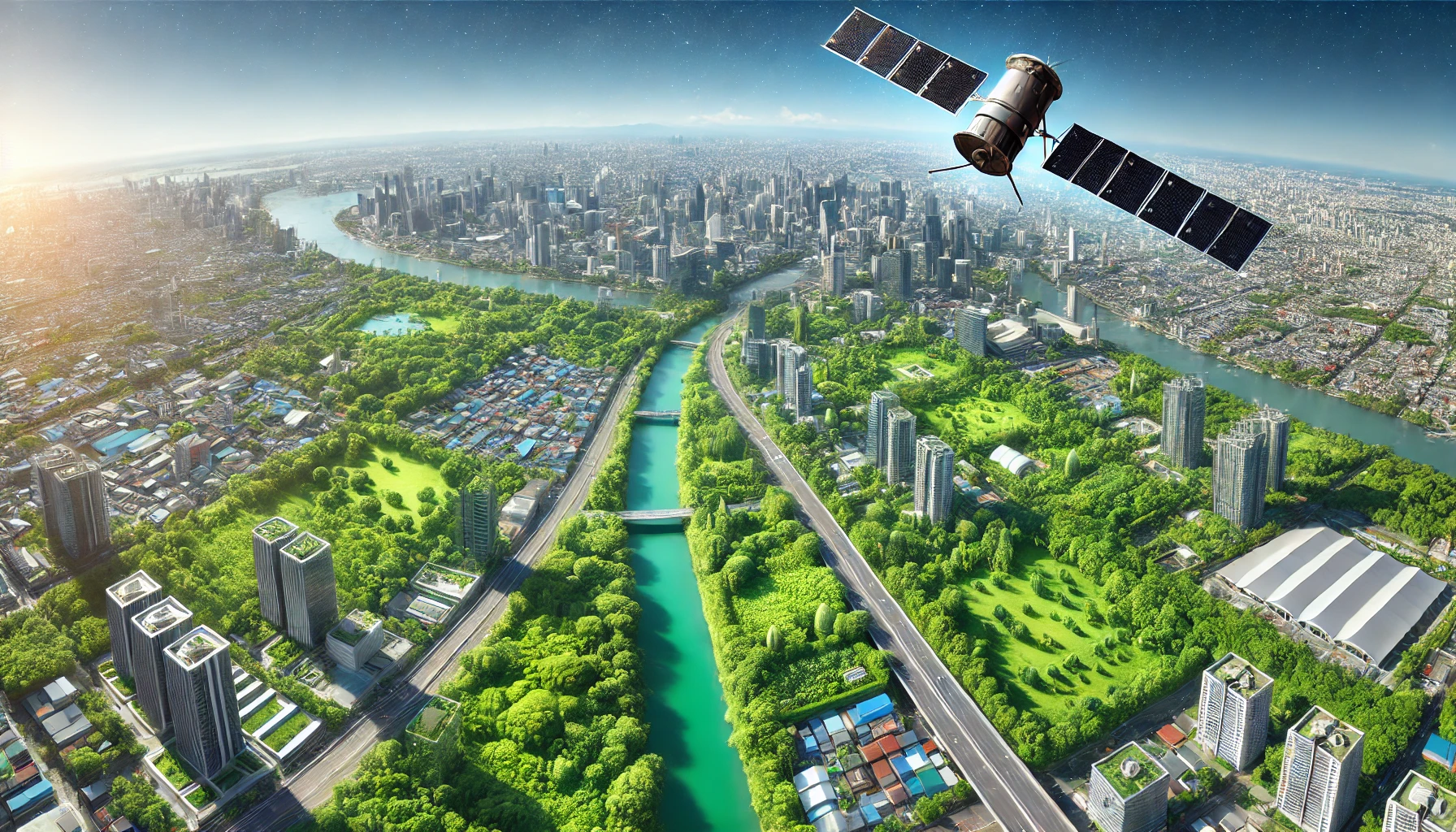
Revolutionizing Urban Tree Monitoring with AI and Satellite Technology
ForSens empowers cities to make proactive, data-driven decisions by continuously monitoring the entire trees of a city, detecting risks up to 16 months earlier, and assessing the effectiveness of measures—saving costs, protecting trees, and fostering safe, vital urban green spaces.
1. Who is Karuna Technology?
Karuna Technology is a spin-off from TU Darmstadt and a former member of the ESA Business Incubation Centre. The company develops satellite-based solutions for monitoring and managing urban vegetation – particularly trees and green spaces.
2. In which cities is Karuna already active?
Karuna collaborates with cities and municipalities in Germany (e.g., Mannheim, Stuttgart, Krefeld, Neckarsulm, Potsdam, Aschaffenburg), Italy (Rome, Prato), Switzerland (Zurich), Saudi Arabia, and the United States (including Central Park in New York City).
3. What does the ForSens system offer?
ForSens is a cloud-based monitoring system that uses satellite data to:
- Automatically detect, measure, and inventory trees
- Assess the vitality of each tree on a monthly basis
- Monitor lawns and green spaces with high frequency
- Quantify the ecosystem services provided by the urban tree population
- Identify stress factors such as drought weeks to months earlier than visual inspection
- Provide historical data (up to 5 years) for evaluating the effectiveness of interventions
4. What are the advantages over traditional methods?
- No need for expensive sensors: No installation or maintenance required
- Frequent data collection: Up to 3–5 satellite images per week in summer (weather-dependent)
- Early warning: Detects declines in tree vitality up to 18 months before visible symptoms appear
- Cost savings: Much lower monitoring costs with broad spatial coverage
- Objective measurement: Clear documentation of maintenance and restoration efforts
5. How does the system help minimize risks?
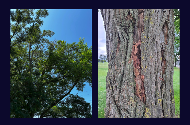
A tragic example: In Rome, a falling poplar tree caused a fatal accident. ForSens had already detected a significant loss of vitality 10 months earlier. If the alert had been acted upon, the accident might have been prevented.
ForSens helps identify high-risk trees early so that preventive actions can be taken.
6. Can private trees also be monitored?
Yes, ForSens can also detect and assess trees on private land. These trees often provide an above-average contribution to ecosystem services and should be considered in urban planning and decision-making.
7. What are common use cases?
- Monitoring of tree populations in public parks and street tree inventories
- Effectiveness tracking for interventions like fertilization, soil decompaction, or root treatments
- Monthly vitality updates for each individual tree
- Early detection of declining trees to reduce the risk of accidents
8. How can I learn more about the technology?
We’d be happy to present our solution and relevant use cases in a personal meeting or call. Just get in touch – we look forward to connecting with you!
Currently cities face a multitude of challenges
1. Climatic Change:
Trees are facing increased heat stress, drought, and new diseases and pests, while natural disasters become more frequent and severe.
2. Political Pressure:
To mitigate the impacts of climate change, many cities are focusing on planting more trees. However, regulations around pesticide use and irrigation are becoming increasingly stringent.
3. Staff Shortage:
While climate change and political pressures demand more personnel to address these challenges, a shortage of skilled labor and trained arborists is making it even harder to manage urban trees effectively.
How our Technology works
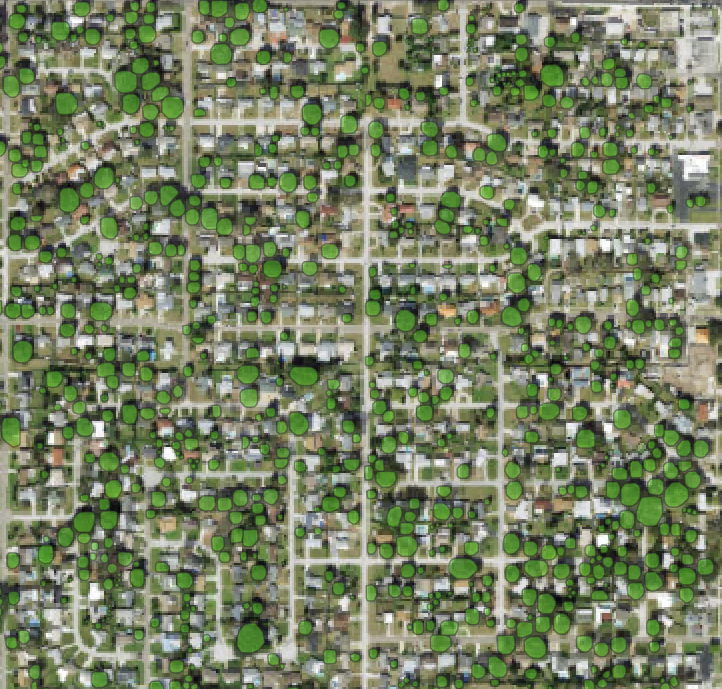
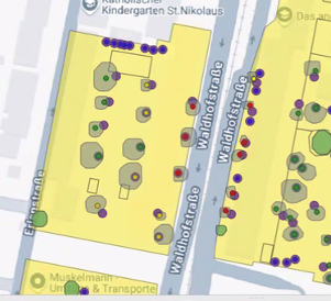
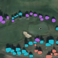
Tree Detection: Our advanced AI algorithms, powered by Deep Neural Networks used in technologies like Autonomous Vehicles, are fine-tuned to analyze high-resolution satellite and aerial imagery. This enables us to accurately detect, measure, and geo-locate trees, while precisely assessing their ecosystem services.
Vitality Monitoring: Through multispectral monitoring with the highest available spatial and temporal resolution, we continuously track tree vitality of the trees. By utilizing wavelengths outside the human visual spectrum (e.g., Near Infrared Light Spectrum), we can detect vitality loss more quickly and objectively compared to a human eye!
Integration to GIS System: Integration with GIS Systems: We offer geo-referenced file exports (e.g, GeoTIFF or Shapefile) that can be seamlessly imported into your GIS or tree inventory software. This ensures effortless integration into your daily operations.
Our Use Cases
The ForSens Technology could be applied in various ways:
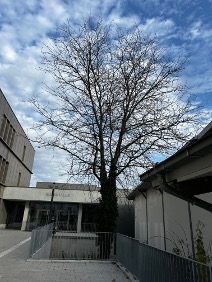
Setup of a Tree Inventory
Our technology allows for the accurate detection, measurement, and geo-location of trees, enabling you to create a comprehensive tree inventory. Additionally, it helps assess the ecosystem services provided by each tree, giving you a deeper understanding of their environmental contributions.
Proactive Stress Prevention
By continuously monitoring tree vitality, our system can detect early signs of stress, helping to identify when trees are most susceptible to drought, disease, and pest attacks. This early detection allows for timely interventions to prevent damage and maintain tree health.
Tracking the Effectiveness of Measures
Implementing measures like fertilization, root treatments, and soil aeration can be costly. Our system tracks the effectiveness of these actions, providing detailed insights into how they impact tree health and vitality over time, ensuring that resources are spent efficiently.
Tree Monitoring During Construction
Construction projects often pose a risk to tree health, particularly when tree roots are damaged. Our system helps monitor trees during construction activities, detecting any root damage that could compromise the tree’s vitality and structural integrity, allowing for early interventions to safeguard tree health.
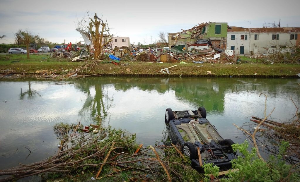
Real-time Damage Assessment after Storm Events
Storms can cause both immediate and delayed damage to trees, which can sometimes go unnoticed until it’s too late. Even months after a storm, structural damage or compromised vitality may lead to tree collapse, posing risks to property, infrastructure, and safety.
Our system provides a real-time inventory of tree vitality, allowing you to quickly assess and track the health of trees following storm events. By continuously monitoring and analyzing tree conditions, the system identifies subtle signs of stress or damage that may not be visible to the naked eye.
This enables you to pinpoint trees that may be at risk of failure, prioritize them for further inspection or intervention, and implement necessary protective measures. The real-time aspect of this monitoring supports timely decision-making and helps ensure that potentially hazardous trees are addressed before they cause significant problems. Additionally, this system allows for long-term tracking of tree recovery or decline, giving you valuable data to inform future tree care strategies and storm preparedness plans.

16 months
Quicker then traditional methods.
Our technology allows you to detect trees at risk up to 16 month quicker, allowing you to act proactively!
200.000+
Monitored Trees globally
We monitor over 200.000 trees all over the world in different climate zones, growing conditions and tree species.
99% cheaper
Compared to traditional methods
We are able to monitor entire cities 99% less costly compared to traditional methodologies.
5 years
Historical Data available
We are able to provide you 5 years of history from day one. Allowing you to track how
Let’s Work Together
ForSens is a product of Karuna Technology UG
ForSens has been funded by the excellence grant Loewe of the Hessian Ministry of Science, Research, Arts and Culture.